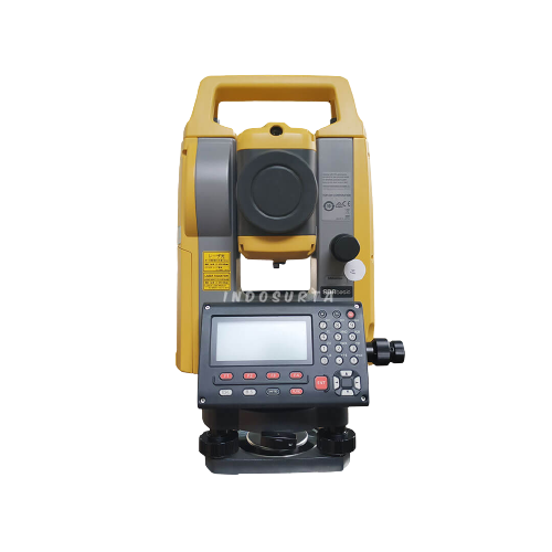
Deskripsi
- Sistem RTK GNSS V200
Penerima GNSS RTK V200 menghadirkan kinerja unggul dan efisiensi tinggi untuk mendukung pekerjaan lapangan Anda dengan solusi yang andal. Penerapan mesin RTK canggih dan IMU 9-sumbu generasi baru menjamin peningkatan kinerja sebesar 25% bahkan di lingkungan yang paling menuntut sekalipun. Dengan demikian Anda dapat mengandalkan Hi-Target V200 untuk produktivitas yang lebih baik.
- Akurasi dan Presisi Lebih Tinggi
Dilengkapi dengan Antena Patch Berkinerja Tinggi, meningkatkan kemampuan pelacakan sudut elevasi rendah dan menjaganya mempertahankan penguatan tinggi untuk satelit dengan elevasi lebih tinggi sambil melacak satelit dengan elevasi rendah.

- Lebih Stabilitas
Hi-Target Hi-Fix memungkinkan konektivitas berkelanjutan dan hasil berkualitas bahkan jika Anda kehilangan sinyal saat menggunakan stasiun pangkalan RTK atau jaringan VRS dalam kondisi ekstrem.

- Lebih Banyak Portabilitas
Dilengkapi dengan kotak instrumen bahan EPP ultra-ringan dengan anti benturan kuat, ketahanan guncangan dan benturan yang tinggi serta batang pemusatan yang dapat dikontrak hingga 1,25 m, menjadikannya tahan lama dan portabel dalam pekerjaan lapangan.
- Fleksibilitas Lebih Besar
Hal ini dapat memberikan hasil yang akurat dan andal serta meningkatkan kerja lapangan yang efisien dengan IMU dan algoritma inti bawaan yang di kembangkan sendiri.

Spesifikasi GPS Geodetic Hi-Target V200 GNSS RTK
GNSS Signal
- Channels: 800+
- GPS: L1 / L2 / L5 / L2C
- BDS: B1 / B2 / B3 / B1C / B2a
- GLONASS: L1/L2/L3
- Galileo: E1 / E5 / AltBOC / E5a / E5b / E6
- SBAS: L1 / L5
- QZSS: L1 / L2 / L5 / L6
- IRNSS: L5
Positioning Performance
- High Precision static GNSS Surveying
- Horizontal : 2.5mm + 0.1ppm RMS
- Vertical: 3.5mm + 0.4ppm RMS
- High Precision static GNSS Surveying
- Static and Fast Static
- Horizontal: 2.5mm + 0.5ppm RMS
- Vertical: 5mm + 0.5ppm RMS
- Static and Fast Static
- Post Processing Kinematic (PPK / Stop & Go)
- Horizontal: 8mm + 1ppm RMS
- Vertical: 15mm + 1ppm RMS
- Initialization time: Typically 10 min for base and 5 min for rover
- Initialization reliability: Typically > 99.9%
- Post Processing Kinematic (PPK / Stop & Go)
- Code Differential GNSS Positioning
- Horizontal: ±0.25m + 1ppm RMS
- Vertical: ±0.5m + 1 ppm RMS
- SBAS: 0.5m (H), 0.85m (V)
- Code Differential GNSS Positioning
- Real Time Kinematic (RTK)
- Horizontal: 8mm+1ppm RMS
- Vertical: 15mm+1ppm RMS
- Initialization time: Typically <10s
- Initialization reliability: Typically > 99.9%
- Real Time Kinematic (RTK)
- Time to First Fix
- Cold Start: <45 s
- Hot Start: <30 s
- Signal re-acquisition: <2 s
- Time to First Fix
- Hi-Fix
- Horizontal: RTK+10mm / minute RMS
- Vertical: RTK+20mm / minute RMS
- Hi-Fix
- Tilt Survey Performance
- Additional horizontal pole-tilt uncertainty typically less than 8mm +0.7mm / °tilt (2.5cm accuracy in the inclination of 30°)
- Tilt Survey Performance
Communication
- Communication
- Bluetooth: 4.2 / 2.1+EDR, 2.4GHz
- WiFi: Frequency 2.4GHz, Supports 802.11a/b/g/n
- Communication
- Internal UHF Radio
- Frequency: 410-470MHz
- Channel: 116 (16 scalable)
- Transmitting power: 0.5W/ 1W / 2W adjustable
- Support multi-communication protocols:
- Hi-Target
- TRIMTALK450S
- TRIMMARK III
- TRANSEOT
- SATEL-3AS
- etc.
- Internal UHF Radio
Physycal
- Internal Battery
- Internal 7.4V / 6800mAh lithium-ion rechargeable battery
- RTK Rover (network) for 12 hours
- Static: up to 15 hours
- Internal Battery
- External Power
- Power Consumption: 4.2W
- Dimension (W x H): 132mm x 67mm
- Charging: using standard smartphone chargers or external power banks
- Weight: ≤0.8kg (include battery)
- Data Storage: 8GB ROM internal storage
- External Power
Control Panel
- LED Lamp:
- Satellite
- Signal
- Power
- Physical button: 1
- LED Lamp:
Environment
- Water / Dustproof: IP67
- Shock and vibration: Designed to survive a 2m natural fall onto concrete
- Humidity: 100%, condensing
- Operation Temperature: -30°C~+70°C
- Storage Temperature: -40°C~+80°C
I/O Interface
- 1x USB port, type C
- 1x SMA antenna connector
Data Formats
- Output rate: 1Hz-20Hz.
- Static data format: GNS, Rinex
- Network model: VRS, FKP, MAC; supports NTRIP protocol
- CMR& RTCM: CMR, RTCM 2.x, RTCM 3.0, RTCM 3.2
- Navigation outputs ASCII: NMEA-0183
Layanan purna jual
- Garansi servis 1 tahun
- Gratis training alat
- Gratis pengiriman dan juga COD khusus Kota Surabaya dsk
Tentu saja kami juga menerima pengiriman keluar Surabaya
Lalu kami juga tersebar luas di kota – kota seluruh Indonesia, seperti :
- Balikpapan
- Makassar
- Batam
- Surabaya
- Palembang
- Medan
- Manado
- Cikarang
- Semarang
- Banjarmasin
- Kendari
- Jakarta
- Samarinda
Baca juga : Seberapa penting sih peran satelit GPS dalam dunia militer?


